Atlas Maps
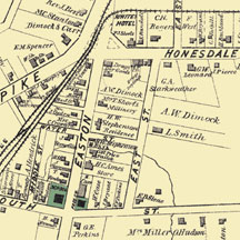
We provide reproductions of 19th century historic county atlas maps. Maps have been digitally scanned and are available in sizes ranging from 14"x18" up to 24"x36". Drawings can be ordered on various media ranging from basic heavyweight paper to canvas.
If you can not find a specific town, township or family name,
email us and we will check for you.
These maps are ideal for anyone searching family history. Many maps contain detailed information of the areas during the time period including the following:
- houses and farms with owners names
- commercial and industrial buildings
- schoolhouses, churches, cemeteries
- mills, hotels, collieries, breakers
- railroads, depots, service facilities
- rivers, streams, reservoirs